Survey and Seismic
Survey and Seismic
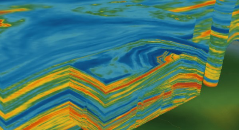
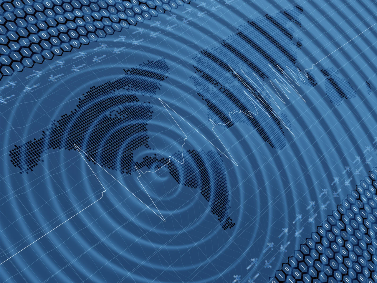
Precision in Every Seismic Detail, Clarity in Every Decision
PT Waviv Technologies is your partner in transforming seismic data into clear, actionable insights. Our advanced technologies—SARP, DRECT, HIT, CSS, and AERIS—enhance data quality and enable precise, high-resolution geophysical analysis. Whether it's improving vertical resolution, detecting hydrocarbons, or optimizing survey acquisition, we provide tailored solutions that empower energy exploration with unparalleled clarity and efficiency.
SARP
(Seismic Advanced Reconstruction Processing)
Turning Low-Quality Seismic Data into Reliable Insights
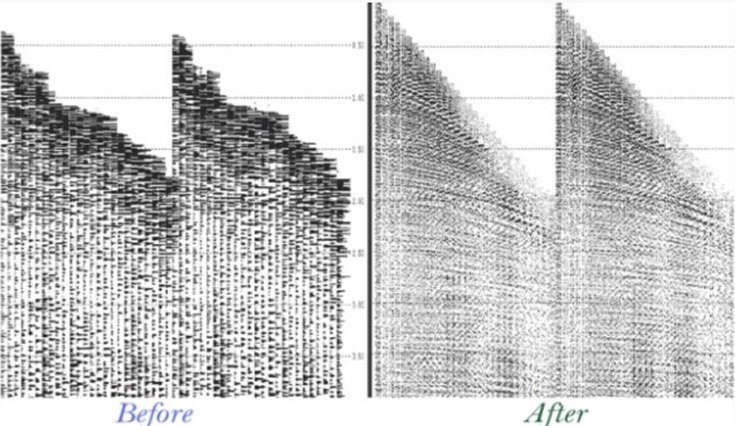
SARP offers a fast and reliable method to enhance seismic resolution by reconstructing buried signals through signal redundancy. By utilizing existing seismic data (PTSM or PSDM gathers, pre-stack or stack images, 2D or 3D), SARP avoids the need for complete re-processing, saving time and resources.
Our cutting-edge technology focuses on improving poor-quality data, restoring missing signals, removing noise, and increasing data fold and signal-to-noise ratios. With a specialized workflow built for detailed G&G analysis, SARP ensures seismic data is optimized for amplitude and inversion studies.
DRECT
(Dynamic Resolution Enhancement for Complex Targets)
Refined Seismic Data for Insightful G&G Analysis
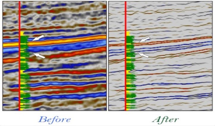
DRECT provides a fast, reliable solution to enhance stratigraphic and structural insights by improving vertical resolution in seismic data. The key advantage is delivering superior input for G&G analysis, maximizing data quality for amplitude and inversion studies.
At Waviv Technologies, we specialize in producing accurately processed seismic data, customized to meet specific objectives like deep targets, fracture basement, or thin-layer detection. DRECT unlocks hidden data insights, optimizing stratigraphic analysis and lithological inversion to boost confidence in volumetric calculations and G&G evaluations.
HIT
(Hydrocarbon Indication Technologies)
Uncover Hydrocarbon Anomalies
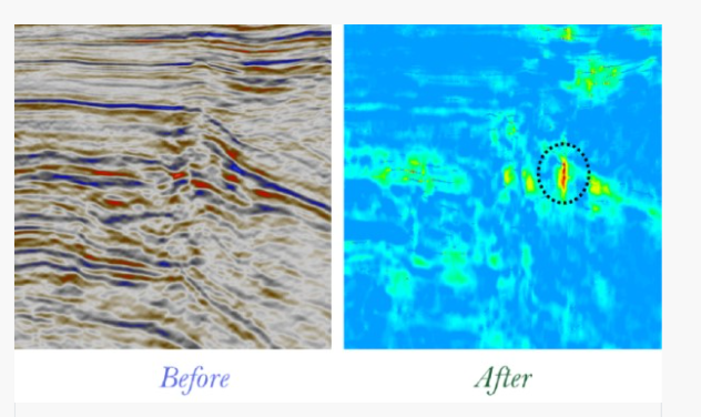
HIT is an innovative methodology developed by our R&D team to enhance Direct Hydrocarbon Indicators (DHI) and streamline exploration. Designed for time and cost efficiency, HIT reliably predicts hydrocarbon anomalies without relying on conventional quantitative interpretation. This advanced technique has been successfully applied across various depositional environments, including areas with complex structural challenges.
Elevate Your Exploration Strategy with HIT’s Triple Screening Approach—local anomaly detection, low-frequency anomaly analysis, and frequency-dependent AVO. HIT strengthens hydrocarbon anomaly identification, helping pinpoint the highest prospect targets during exploration.
CS3
(Compressive Sensing Seismic Survey)
Achieve a new level of efficiency in seismic acquisition
Seismic surveys, particularly in land and transition zones, often face challenges that lead to irregularities, low fold, and poor-quality data. To meet the demands of modern exploration, achieving higher efficiency while reducing costs is essential.
CS3 leverages cutting-edge compressive sensing technology to restore missing signals from limited data samples, offering a breakthrough solution for seismic acquisition. This technology balances fold, enhances azimuth coverage, and improves velocity modeling with better semblance, all while being AVO-friendly. CS3 provides top-tier seismic data while maximizing cost efficiency.
AERIS
(Aerial Intelligent Survey)
Transforming Seismic Challenges into Strategic Solutions with Aerial Precision
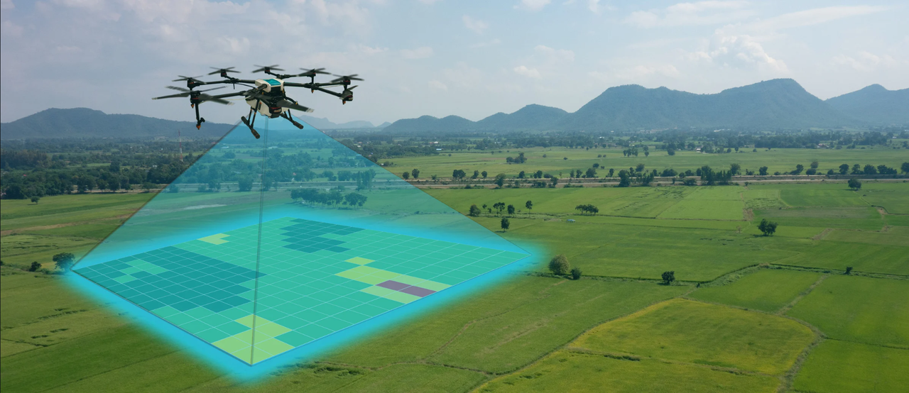
Land seismic acquisition presents complex challenges, necessitating smart integration of personnel, tools, and budget. AERIS provides tactical support for successful seismic surveys by offering detailed environmental insights to enhance acquisition planning.
Utilizing the latest drone technology, we efficiently manage aerial surveys across various scales, ensuring timely and cost-effective results.
Our Projects
Waviv Seismic & Survey Projects
| No | Client | Project |
|---|---|---|
| 1 | BP | Testline : 2D Marine Advance Seismic Reprocessing, East Arafurazpan 2 Area |
| 2 | Caelus Energy South Bengara I Pte.Ltd | 2D Advance Seismic Processing - South Bengara I Block, Tarakan, East Kalimantan |
| 3 | Camar Resources Canada, Inc. | 3D Seismic Enhancement Study - Bawean Sea - East Java |
| 4 | Dinas Perhubungan Kota Semarang | Update on Parking Data Evaluation for the Fiscal Year 2021 |
| 5 | Dinas Perhubungan Kota Semarang | Parking Data Collection for the Fiscal Year 2021 |
| 6 | JOB Pertamina Minto-E&P Simenggaris | Testline : 2D Marine Advance Seismic Reprocessing, Semenggaris Block |
| 7 | KSO Pertamina EP - Samudra Energi Tanjung Lontar | Test Line & Processing Data Seismic 2D (PSTM & PSDM) - Muara Enim & Air Benakat Formation |
| 8 | Landmark Concurrent Solusi Indonesia | Machine Learning Project PHM Tunu IT Development Services |
| 9 | Landmark Concurrent Solusi Indonesia | Machine Learning Project PHM Tunu Data Scientist Services |
| 10 | Landmark Concurrent Solusi Indonesia | Machine Learning Project PHM Tunu Asisstant Data Scientist Services |